Walking with sharks: Day 4


This is the story of a semi-grey nomad's ground breaking attempt to circumnavigate the Peron Peninsular, hiking mainly on the beach from Denham to Monkey Mia. 

Day 4: From Skipjack Point to Herald bight. North to South.


Standing on the edge of a steep cliff next to the light house at Skipjack Point my knowledgeable companion pointed out controversially how global warming had affected this area. "There used to be a goat's trail down towards the beach but it looks like it is all washed away by the ocean" he said. "You've gotta find yer own way down further on". Off I went, following a tiny trail high above the beach. I could only see goat and kangaroo prints on this trail. The soft sand and up and down nature of the trail soon had my heart rate up high. In some places my shins got a good scratching from low, sharp bush I still don't recognise. After about 500 metres my precarious balancing act on the ledge had come to an end when my patience was rewarded with a safe passage down to the beach below. Any attempt to decend before that would had been foolish and would have come to a sticky end.


A little kangaroo trail next to a steep drop


At the first rocky point I rounded, I pathetically slipped on a wet rock and both my feet slipped into the water. As you can see, unexpected small incidents always happen on hikes like this no matter how experienced you think you are. I took my shoes and socks off against my better judgement and dangled them off my pack in the hope for them to dry.

A slippy rock formation

The wind was offshore which made the water still and crystal clear. I enjoyed perfect walking conditions. Flat, hard beach and later when the tide had receded even more, I could walk on the tidal flats for many kilometres short-cutting to my destination.


Selfie of size 13 foot in crystal clear water
 
 
Walking bare feet is always a risk in these parts and I took a fair amount of skin off my big toe when my foot met a much more rigid object called "a rock". I am sure something nasty happened to my 'second toe in command' ranging from a mild sprain to a small split in the bone perhaps. Just keep going Mars! At least my socks were dry!!!!!

A sea-gull in full flight
 
 
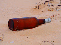
Having rebooted my feet, I noticed there were a few washed up items laying around on the beach. I could have built a life raft out of all the washed up water containers. There was no message in this bottle, nor was there a naked woman running around that belonged to these undies.


Love heart tiger undies???

On the muddy flats that I was walking, many birds appeared. Sea-gulls, oyster catchers, turns and lesser sand plovers. The last are these cute little foragers that will not let you anywhere more than about 15 metres near them. They must be amazing flyers as they lay their eggs above the tree line in the Himalayas and then visit us in Australia.


The Lesser Sand Plover no less


This bunch of goats came running towards me and looked inquiringly at me from about 50 metres. At one point I was rummaging around for my "self defence booklet against goats" but I courageously stared them down. Amazingly, to avoid my glaring gaze, they randomly ran up that same steep cliff I had just walked 500 meters along to find a safe way down. 


Ninja goats


Today's pick up was a smooth affair with my man of know-how appearing at Herald Bight as soon as I limped onto its white sand.


Another day, another shark


Grey Bits


To avoid having to hike on a rocky, dangerous ledge I suggest that one could start walking along the beach from Cape Peron and rounding Skipjack Point down below. It is a little bit further, but it is a lot safer option.

Today's walk is approximately 12km long and could easily be done as a day walk with car access on both ends.

Please note, that this hike is through very wild, uninhabited country. In my opinion it is not advisable to attempt this hike without a support team or proper communication devices like a satellite phone or  EPIRB. Hiking experience in this area is a must.


A shovelnose ray


Let the Department of Parks and Wildlife  know where you are going to be and when you plan to return. Phone (08) 9948 2226 or click on the following links www.sharkbay.org, www.dpaw.wa.gov.au for more information.

The best time to walk around the Peron Peninsular is at low tide. You can check the tide at www.seabreeze.com.au
 

Pied oystercatcher


Walking with sharks: Day 3


This is the story of the semi-grey nomad's attempt to circumnavigate the Peron Peninsular, hiking mainly on the beach from Denham to Monkey Mia. 

Day Three: From Cape Peron to Cattle Well. North to South and thus wind smack-bang in the face all morning.
 
 
Here is that map again. Saves a scroll down


Cape Peron itself is truly spectacular. It is here that I developed a dune fetish. There are several red orangey, rippled sand dunes and not taking photos is almost a crime.


No sooner had  I left my wise friend behind and walked on an old vehicle track when I bumped into three goats ahead on the trail towards the dunes. Two kids following their mum were happily bouncing along in front of me as if they owned the place.  
 

Tails up
 
Along this 10km stretch to Cattle Well there are three places to camp. Bottle Bay, Gregories and South Gregories with toilets and barbecues. These great camp sites have dunnies I've had the pleasure of cleaning a couple of times when assisting Department of Parks and Wildlife staff during a service run. The best time to camp here is around Easter and in the middle months of the year. In December that southerly is too strong for tenting in my opinion.


Before you reach these campsites you have to walk past Sheila's bluff; a stunning half-bowl shaped cliff face with its colours visible from a long way away. 


Bottle Bay was formerly known as Bottle dump because ships came through and dumped their refuge and bottles in this spot. I can assure you that it is a pretty spot and that Bottle Bay is definitely a more suitable name in its current status. It is a white sandy beach with lots of pristine turquoise water and a bit of seaweed of course. One has to be realistic.


Looking North over Bottle beach towards Sheila's bluff.
 
 
During today's walk I expected it to be busy.  There were car trails on the beach and a couple of four- wheel drive access tracks and the snorkelling is great at Gregories. So far, however, on my three days of hiking I haven't come across another soul.

You just cannot miss that special, pungent sulphur odour of Cormorants that are huddled together on the beach or on the rocks. At first I thought I had eaten something that didn't agree with me but then saw the shags. They are a nervous bunch and they either fly off or swim away on approach. I count myself lucky that I do not live in the time of the old Inca Empire of Peru. Disturbing the Cormorants in those days was met with the death penalty as the guano was a precious comodity. Cormorant excrement or guano in Spanish was used to fertilize their crops; it being rich in Potassium and Nitrogen Phosphate. Some organic farmers of today are using guano as an environmentally friendly fertilizer. In this part of the world Dirk Hartog Island was used for harvesting guano some time ago.


I must say that I feel sorry for the poor soul who has to collect the guano. Rocky ledges, high cliffs and looking for smelly ........


Cormorants on mussel covered rocks at South Gregories
 

On today's hike I saw just the one lonely shark in the shallows. So I am gladly notching the one shark under my belt and referring to the title I am still "walking with sharks" even on day three.

Listening carefully to instructions is very important when meeting up with your support crew after a tough day in the boots. Extra kilometres can be had when one enthusiastically makes the decision to change the meeting point without consultation and walk the wrong way in order to mistakenly curtail your support crews waiting time. This is how I ended up walking from South Gregories to Cattle Well twice, adding a highly unwanted 3km to a lovely easy 10km day, earning the scorn of my all-knowing support.

Shouda listened.
 
 
Grey Bits


Looking South towards the first beach from Cape Peron
 
 
I can highly recommend the 1.5 km walk to Skipjack Point and back. If you are going to walk anywhere in the national park this should be the place. There are many helpful interpetative signs on this strech and views are awesome from high above the sea. 


Euro kangaroo prints in the dune

 
Please note, that this hike is through very wild, uninhabited country. In my opinion it is not advisable to attempt this hike without a support team or proper communication devices like a satellite phone or  EPIRB. Hiking experience is a must.

Let the Department of Parks and Wildlife  know where you are going to be and when you plan to return. Phone (08) 9948 2226 or click on the following links www.sharkbay.org, www.dpaw.wa.gov.au for more information.

The best time to walk around the Peron Peninsular is at low tide. You can check the tide levels at www.seabreeze.com.au


Walking with sharks: Day 2.


The view from Cape Lesueur during todays walk


This is the story of the semi-grey nomad's attempt to circumnavigate the Peron Peninsular, hiking mainly on the beach from Denham to Monkey Mia. 


Day two: From Big Lagoon to Cattle Well. South to North.


“If yer liked your first day, today is even more spectacular” said my expert guide in his broad Australian lingo. We had a long conversation bent over aerial maps relevant to today's hike. Navigating needed to be discussed in detail due to some tricky points traversing around the keyholes of the tidal flats and finding a way through to Cape Lesueur.


The map from Francois Peron National Park


I was dropped on a high point overlooking Big Lagoon and had some work to do to get waterside. After rounding the first of the three large tidal lakes, I came across some old bones that belonged to a dead horse. A kind of eerie discovery from an expired pastoral lease.


Horse bones in the sand

Because of the persistent strong southerly wind, navigation became easy. Wind blowing in the left ear for East and wind in the right lug hole for West. On the back of the noggin is the preferred way today, South. There is no one out here in this arid land and that makes asking for directions impossible. In fact I could be doing cartwheels and backflips naked and no one would know (sorry, no photos included). I must admit I enjoy the solitude which at the same time spurs me on to get back to civilization.


Vast empty spaces around the keyholes


There was a lot of temptation to walk straight across the tidal flats but I was told that the ground could get muddy and uncomfortable to walk on. In my mind I did not want to start a new trail through a World Heritage area or trample over something significant unbeknown to me. I tried sticking to the edge of the flats on a faint car track even though it meant more kilometres.


A Cowtail ray cruising past


Almost around the third key hole a track veers off to the right, up the hill and into the scrub. On top, a couple of hundred metres up, is the last spectacular view you get from Big Lagoon and it is the point where I joined a vermin proof fence for almost 4km to cape Lesueur. It was slow going through the sand but the wild life kept me buoyed. A Bungarra tried to run away from me and kept banging its head to the left into the vermin fence about twenty times in a panic. I stopt walking in its direction to give it some space, even talked to it nicely and then with a presumed headache, the large goanna finally saw the error of its way and disappeared in the bush on the right. I heard bleating nearby from some goats but could not spot them and saw black and white fairy wrens that were too illusive for my camera skills.


One last look at Big Lagoon and a first look at the vermin proof fence


At Cape Lesueur I strolled down the dune taking many photos of the scenery. In fact, I found it hard to put my camera down for the next 10km to Broadhurst. Again, I saw many Nervous Sharks but the cliffs were the highlight of today;s hike. The colours varied from the white beach sand to a yellow clay shade with vivid red on top. In some spots, where rain had fallen down cracks and crevasses of the cliff face, all those colours were mixed up to create what's known as blow outs.


The bluff with an ancient vibe and a little camera trick


A sense of awe came over me at the sight of these rugged cliffs. Walking here felt special as if there was more going on than meets the eye. I would not be surprised if there was any Indigenous significance to these cliffs?


A turtle coming up for a breath and checking me out.


Today;s hike was marred by the underestimation of distance or overestimating of my speed. What does that mean? It was a bloody long way to walk. My lift had been waiting a while at Cattle Well. I finally spotted him perched high above me on top of that cliff. He had been watching me through his binoculars for ages and said in his best Aussie “Looked like you were strugglen.” After calling me “a smelly” which is the local nick name for hikers, we had lunch together and I was made a double spooned instant coffee which tasted “grand” after five hours of hiking.


Checking out the "smelly" from above


Grey bits

Please note, you can not cross Big Lagoon inlet due to strong currents, possible stonefish and sulphur smelling mud. Walking around Big Lagoon is a truly beautiful walk. Don't miss it!

To do a day trip to the above mentioned cliffs you could park your car at Cattle Well, walk four kilometers North and pass a low set of dunes called Broadhurst. This area is very beautiful. There is no public access by car between Cattle Well and Big Lagoon.


Please note, that this hike is through very wild, uninhabited country. In my opinion it is not advisable to attempt this hike without a support team or proper communication devices like a satellite phone or  EPIRB. Hiking experience is a must.


Cormorants taking flight over Shark Bay


Let the Department of Parks and Wildlife  know where you are going to be and when you plan to return. Phone (08) 9948 2226 or click on the following links www.sharkbay.org, www.dpaw.wa.gov.au for more information.

The best time to walk around the Peron Peninsular is at low tide. You can check the tide at www.seabreeze.com.au


 Emus out for their afternoon dip in the water at Broadhurst


Walking with sharks: Day 1


I would love to explore planet Mars. What an exciting frontier and new landscape this would prove. Imagine walking in a weird gravitational floating movement. You could see rocks and craters no one has seen before. Would there be water or flowers or alien like animals. Unfortunately Jetstar has no scheduled flights to Mars and it may take a fair chunk out of your life to get there. Maybe it is better to come down to Earth.

On our planet most frontiers have been inundated with so-called civilization, most oceans have been navigated, land has been discovered and mountains have been scaled. To be ground breaking on this planet may take some lateral thinking and something off the wall.

How about walking around the Peron Peninsular? Lets say I walk from Denham to Monkey Mia but round Cape Peron for good measure.


A handy map of Francois Peron National Park

For two weeks I have discussed the idea of this hike with some of the prominent, knowledgeable people of Denham. The news is good. My local source has told me that there is no memory of such a hike ever been attempted. I am immediately warned that there isn't any car access in many of the parts of the national park. I will be on my own out there, must carry my own water and phone reception will be scarce. Right!!! This is the hard man Bear Grills hike I need to do .........

"and fast"

This is the story of a semi-grey nomad's attempt to circumnavigate the Peron Peninsular, hiking mainly on the beaches from Denham to Monkey Mia. 


Day One: Big Lagoon to Little Lagoon. 


A bearded dragon spotted on the way


"Yer got to walk to that third dune on the left." I was told with a pair of binoculars pressed to my face. Precious information from someone who has walked these parts on many occasions. "Middle bluff is hard to get around as there is thick mud and lotsa mangroves" said my source of information in ocker 'Strayan'. After a warm "goodluck" I set off for Little Lagoon on a ridge overlooking its bigger brother Big Lagoon.


"See that third dune on the left?" 

The first couple of km's I spend finding my way through shoulder high bush on kangaroo trails. At times I had to go back and find another trail to go towards that third dune. Sometimes there was no way forward other than to push through some of these low scrubs. Branches were cracking, snapping underfoot and brushing past my legs. As I am a novice hiker in this area I did not recognise the scrubs that had sharp thorns. The long trousers I was wearing soon were punctured several times scratching my legs till they bled.


An untouched round birrida


A small birrida or clay pan appeared at the foot of a hill and gave my legs some respite from the assault on my legs as birridas are flat and only low scrub grows on them.


A flower growing on a birrida

After two arduous kilometres I arrived at the tidal inlet where walking became easy on hard flat sand. Rather than walking way-around a large lake I thought it was smart to cross the tidal stream that flowed into it. I leapt up high, far and with camera in hand and landed beautifully at the other end. My foot stomped into the other shore as it should, however, the supposedly hard expected sand wasn't there. A smelly, grey, muddy mess squirted up with force and covered most of my legs, outstretched arm and camera. I spent the next half hour cleaning up my camera with the inside of my shirt, the only part not covered in sulphur smelling goo. Literally a semi-grey nomad I continued to battle more bush and dragged myself over some dunes to finally hit the beach.


The point of entry to the beach
The beach was like a walk in the park. That lovely solid summer breeze of Shark Bay was blowing freely into my face. It was low tide which left me with a wide strip of hard sand to get into cruise mode walking style. The shoes came off and I walked some time through the cool, refreshing, ankle deep water. Suddenly I saw something move out of the corner of my eye. Only metres away from me.........a shark??!! Wait a minute - there is another one - and another. When life returned back to my extremities and my mouth had closed again, I quickly stepped back on to dry land and gave my camera a fair work out.


A shark only a couple of metres away

While I continued walking some of the sharks stayed next to me.

I am walking with sharks. Priceless!!!


These sharks, I was later informed, were nervous sharks. They were a maximum of a metre and a half long and shot away as soon as I came anywhere near them. Because I have lots of time when hiking I attempted to count the amount of sharks I spotted that afternoon but gave up after one hundred.


All these black spots are sharks

After a couple of hours walking over tremendous beaches, the tide had reached its lowest point. In the distance I could see the golden sand dunes of Dirk Hartog Island. An Emu was strolling, pecking at bush tucker along the beach coming towards me. When eventually the bird spotted me it became panic stricken and in a flap, sprinted past me on the empty mudflat bringing some much needed comic relief from a hard day at the office.


Flight of the flightless

All animals are nervous today.

 
I turned left off the beach and followed the tidal river to and around Little Lagoon. Another little gem in this harsh land. Julie was waiting at the Eastern side of Little Lagoon and in the car to take this weary hiker home. As I sat down she immediately pulled up her nose when she smelled the semi-grey mud covering my clothes. Eaah. You smell!!

Just another day's work for a nomad.
 
 
Grey Bits


Little Lagoon is a great picnic spot and great for walking short distances. Crossing the tidal river here is not recommended due to stonefish lurking in the shallows. 
 
Please note, that this hike around the peninsular is through very wild, uninhabited country. In my opinion it is not advisable to attempt this hike without a support team or proper communication devices like a satellite phone or  EPIRB. Hiking experience is a must.


TDugong bones I stood on accidently

The opening photo is of Big Lagoon and Middle Bluff.

Let the Department of Parks and Wildlife  know where you are going to be and when you plan to return. Phone (08) 9948 2226 or click on the following links www.sharkbay.org, www.dpaw.wa.gov.au for more information of the area.

The best time to walk around the Peron Peninsular is at low tide. You can check the tide at www.seabreeze.com.au


Featured post

Do Bikinis and Art Mix?

We made sure we visited one of Australia's most iconic art exhibition in the country, even if we had to fly there from Alice Spri...

Popular Posts