Larapinta 4 Great Southern Land


It was cold “all night long”. My tent is suitable for warm Western Australian conditions with the inner tent completely made of mesh. Any wind blows in underneath the fly and when it is below freezing, like it was that night on Big Hill, watch out. I had to set up the gas burner in the tiny porch of my tent so I could remain laying/sitting inside during breakfast while the frosty wind howled around and through my fluro summer shelter. My bottom lip had cracked from the dry gusts of cold air. I needed to get off this hill…. And fast!!!


Getting down Big Hill

Any feeling in my hands had gone and I noticed that they were bleeding from a couple of cuts acquired from yanking out pegs at great speed. John asked me if he could borrow my burner to cook up some porridge for his frozen family if I could spare the gas. His fuel burner wasn’t working, probably frozen. The last I saw was Mum, Dad and four kids all huddled together in a two-man tent defrosting whilst spooning their porridge from the pot in the middle. Definitely the most adventurous family I ever met on any track.

 
Spinifex covered hills around Big Hill

Like a true frost-bitten geriatric I danced down Big Hill as fast as I could. I was praying for the sun to start warming everything up but was still waiting at 1pm. I came to the oldest river in the world, the Finke River - large white gums stood around the banks of the still water body. It is a beautiful  broad river - more broad than the many creeks I have crossed previously.  I was thankful for the hand written sign alerting hikers to the fact of the 300m detour. I didn’t fancy a waste deep wade in water that was as cold as a penguin's pecker.

 
The oldest river in the world

There was a major decision to be made at the Glen Helen Resort turnoff. They not only had hot showers, budget accommodation and a restaurant but open fires and a bar as well.
Tough decision!

At the Finke River hut I stopped for an hour and chatted to two sisters that were hiking in the opposite direction. It was busy around the hut with several groups coming in and out using the long drop throne and other facilities of the trekking shelter.


The Finke River Hut

Wednesday 13 July 2016

Section 10: Finke River to Ormiston Gorge

Section 10 is a 9.1km section of the trail. This has some steep ascents and is one of the shorter sections of the Larapinta Trail. This section winds through limestone hills at the headwaters of the Finke River, one of the world's oldest rivers.
 
Information from the Government website on the Larapinta trail


Lots of ups and downs through this section
 
The following stretch was a winding, mind-numbing hike through the most amazing barren land. In the end I forced “all night long” (Lionel had to go) out of my mind and changed the ol' LP to “Great Southern 
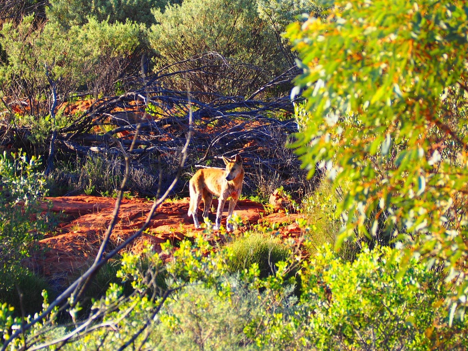
Land". I sang it out loud for the Kangaroos and all the other critters that were out there somewhere. Nobody else would have heard.

Great Southern Land, burned you black
 
So you look into the land and it will tell you a story
Story ‘bout a journey ended long ago
Listen to the motion of the wind in the mountains
Maybe you can hear them talking like I do
“. . they’re gonna betray you, they’re gonna forget you
Are you gonna let them take you over that way . .”

 
Great Southern Land, Great Southern Land
You walk alone, like a primitive man
And they make it work, with sticks and bones
See their hungry eyes, its a hungry home

 
I hear the sound of the stranger’s voices
I see their hungry eyes, their hungry eyes
Great Southern Land, Great Southern Land
They burned you black, black against the ground

Written appropriately by Ivor Davies of Icehouse

 
I was punching the air by the time I reached Ormiston Gorge late in the afternoon. Funny how arriving after a tough day is always memorable. At Ormiston, but only after a hot shower, I got to know and enjoyed the company of  a group of five youngsters. Young people for someone as ancient as myself seemed awfully fresh-faced but we got along famously.

Looking towards Ormiston Gorge from the top of a lookout


One of the girls of the group had been walking the whole track from Alice to Ormiston wearing one boot and one thong as one of her hiking boots fell apart on the first day. How tough must this chick be??? An eighteen year old young fella split out of his trousers and only had one set of clothes left and told me how cold he was every night. The oldest of the bunch was a geography student who told me how interesting the MacDonnell ranges were for him from a Geographical sense. At the café of Ormiston Gorge they bought a $25 pizza and gave me a slice which was extraordinarily generous. They told me they were short on food and I gave them all the supplies I could spare.

Night fell while cooking and chatting to this inspiring fivesome. A great Ranger talk with slide shows and information about local flora and fauna capped off a great evening.


Grey Bits

Check out the details of the Ormiston Ranger talks here
http://www.nt.gov.au/westmacs/things/activity/52


The gumtrees in the Finke River bed
I recommend a tent with higher resistance to the cold for the Larapinta or a good warm sleeping bag.

Read more about the Finke River use the following link https://en.wikipedia.org/wiki/Finke_River

Larapinta 3. How to Freeze a Family


As I was writing about the howling, lone dingo last night my pen ran out of ink. A slight inconvenience in the life of a small-time writer. The Latvian lady came to the rescue and she gave me hers. She was leaving the track in a couple of hours anyway and I was just about to set off. I thanked her and told her that giving was good Karma. She told me how grateful she felt when a stranger made her a coffee at Ormiston Gorge. Some people are just really nice.


One of the many creeks I crossed

 
Tuesday 12 July 2016


Section 11: Finke River to Redbank Gorge
 
Section 11 is a 26km section of the trail. You will need to camp overnight to finish the section. The first part of the trail goes across spinifex-covered hills with the spectacular backdrop of Mt Sonder, then crosses the Davenport River and climbs to a hilltop lookout.
 
It descends to shady and peaceful Rocky Bar Gap at the base of Mt Sonder. It passes through this gap and travels along the southern side of Mt Sonder to Redbank Creek.  
 
Information from the NT Government website


I never took my jacket off that day. Mount Sonder looked gloomy and, wait for it, sombre, under an overcast sky. The track, mainly flat and gravelly ,alternating with flat, red dusty area. This land is surprisingly dry with only the toughest scrubs and trees surviving here even in the midst of winter. I crossed many waterless creek beds and spinifex was growing plentiful along the track in places similar to arranged manicured gardens.
 
 
The spinifex garden
 
Despite the arid atmosphere, I could not believe the multitude of flowers growing in the bush. I stopped many times to take photos. This task has become way more arduous with a heavy backpack.
 
Pack off - get camera - take a breath - shoot - put away camera - lift pack on (swear!).
 
 
Gloomy skies overhead
 
 
I had a huge lunch/morning tea at the Rocky Bar Gap Campsite.  Any thought I entertained to stay overnight was blown away by the intrusive 24 hour surveillance camera mounted on a pole overlooking the water tanks. Why have a camera in this desolate place? Who would have been out here to abuse this pristine spot? Isn’t it funny,  I have been recorded millions of times by CCTV cameras in many places of our fast moving world - yet this one made me feel uncomfortable.  I battled the urge to drop my dacks and moon whoever is watching the screen on the other side.
 
 
A Desert Rose
 
I filled every spare bottle I possessed with water and cussed under my breath when I hoiked the beast over my shoulders. After walking carefully through the dry creek bed aptly named Rocky Gap and traversed over a relatively flat area I came to a hill - a big hill - with the most obvious yet uninspiring name, Big Hill.
 
 
Flowers growing at the foot of Big Hill
 
It took me a while to get to the top as it was BIG. Underway I heard somebody yell out a cooooie!!! from the top which I answered. I also found some flowers that were picked on the ground. There must be kids here somewhere I thought.
 
At the top I decided to stay and tried to find a place to camp with a little shelter from the piercing wind. A glorious brief snooze was in order after which I ventured out of my tent wearing all my clothes, including thermal underwear and a beanie. Six post meridiem and it was bitter. 
 
I met the only other adventurers that were crazy enough to stay up here. Unbelievably, a family of six were braving the icy conditions. Mum and Dad (John and Lara) were passionate hikers and have always taken their kids hiking from an early age. The family including the kids Hannah, Sancha, Finn and little Eddie were spread out in three tents across the top of Big Hill.


Rugged up for dinner
The enthusiastic and definitely driving force behind it all, John, told me he carried his six year old daughter most of the way up only to have to return to his massive pack to haul it to where he had left the six year old Edie - pronounced Ee dee. He said he got to know Edie very well as she chatted to him the whoooooole day long.


Edie not scared of a chat

A cheeky Edie appeared to take a bit of a shine to me and accidently slapped my arm on many occasions as she happened to walk past. I was included in sharing some of the families chocolate and John loaned me his phone to call Julie to arrange our meeting in two days time. I was on the good side of Karma up there.


Sisters in front of Mount Sonder
 
The view from Big Hill was great, but the cloud cover was smothering the sunset. Just before the sun was about to disappear behind the horizon it peaked through an ever so slight opening lighting up the veil hanging over sombre Sonder. We gathered at the edge of Big Hill and stood there for quite some time. “Will you look at that” said John several times.
 
“This has made it all worth it”.


'It was'


Grey Bits
 
Do you want to become a guest blogger, write your own story and publish on my blog? I would love to hear from you. Email me at storiesfrommars@gmail.com

Expect cold weather when hiking the Larapinta in winter. Day time temperatures on the day I walked to Big Hill barely went over ten degrees, but average out to around 20 degrees for the months of May to August. Night time temperatures during these months average around 5 degrees but I was told they can wildly fluctuate. Read more about the current conditions on the Larapinta at https://nt.gov.au/leisure/recreation/bushwalking-hiking/larapinta-trail/larapinta-trail-current-conditions
There is barely any phone reception on the whole of the Larapinta trail. In certain high spots and closer to Alice Springs people who are with Telstra are able to get some bars.

I say lose the phone!!!

Larapinta 2. That Flying Feeling


‘What the……’??? I awoke with a shock by the sound of voices in the night. Flashes of head torches blinding my caked up eyes. What time is it? 4am?? A large group of hikers noisily clonked past my tent. Soon, more came all chatting along excitedly. I realised that there must be a couple of very early sunrise tours to the top of Mount Sonder. Unfortunately, I have put my tent right next to the trail. Exhausted from blowing my nose and the sounds of the wiggles in my head, I roll back over. Cold air biting my face inside the tent. No need to hurry I told myself lazily.

Monday 11 July 2016

Section 12: Redbank Gorge to Mt Sonder return

Section 12 is a 15.8km return section of the Larapinta Trail.

It is a very difficult climb to the peak of Mt Sonder but is worth the effort. There are breathtaking views in all directions. The view looks over ranges, plains, valleys and salt lakes. This is a place to experience the grandeur of the desert landscape.

Information from the Government website on the Larapinta trail

 
The decision making process was very slow, almost non-existent that morning. My head feeling like it was invaded by several herds of woolly sheep. After a huge bowl of cereal and fake milk (powdered) I had gathered up enough energy to slam a daypack together and get started. I left my tent and contents in the creek bed and carried some basics for the ascent to Mount Sonder.
Why I left my lunch and sunglasses in my tent is still a mystery to me.


The exposed trail up Mount Sonder, early in the morning 


First, I would like to acknowledge the traditional owners, the Arrente people, of the land I am about to embark. It is an absolute privilege to be able to wander through this ancient land of our indigenous ancestors.


Magnificent Arrente country. The land ahead waiting for me

 
It was cold, but the wind became seriously freezing the higher I climbed the ridges of Mount Sonder. My right ear feeling frost bitten by the icy cross breeze started aching on the inside. My word!!!! This desert gets cold.  I fished my raincoat out of my backpack to stop the wind from blowing straight through my clothes. I realised that I was no longer on that balmy Kokoda trail. The upwards gradient wasn't too bad but there were some flat, luxurious sections where I could catch my breath. All the way up I greeted many hikers returning from the top, mostly woman, that looked red-faced, with teeth chattering and wrapped up in thick layers of clothes. Mild hyperthermia, the best punishment for waking this sleeping nomad earlier that morning I thought without justification.


The only companion up the top was a jar of squashed peanuts.
 Excuse the brand placement


Meanwhile, the views were getting better as I went along and when I reached the end of the trail the view was grandiose. Towards the North  (relatively close by) is the actual insurmountable Mount Sonder summit. The wind dropped away, the sun warmed everything up (squint) and I found myself up there all alone with my jar of peanut butter for at least one hour. I stood up there, for a while, with arms outstretched as if I was flying. Brilliant spot!!!
Views of the actual summit of Mount Sonder from the end of the trail
 
On the way down the views were open and magnificent.  I got a good look at the highest peak in the Northern Territory, Mount Zeil. Zeil meaning sail mountain in Dutch.
 
Mount Zeil in the distance (1.531m tall)

Back in the riverbank of the Redbank Gorge, I moved my tent away from the track and under a tree for shade. The scouts had left, but a woman had pitched her tent not far from me.  I initiated a conversation with her. It turns out she was of Latvian decent, appeared a little shy and had really struggled throughout this hike. The Latvian lady told me she had learnt a lot about hiking during her stint on the Larapinta and that she had run out of money. The lone hiker asked me if she could borrow my gas burner to boil some water for a packet of dried mashed potato. She said she had a gas bottle but hadn't brought a burner???? No problem, needless to say, as trekkers like us always tend to share and help each other as much as possible.

A week later I learned that a hiker had a gas bottle and some food stolen from their supply box at the Ellery Creek storeroom. What a low thing to do! Most of the contents of these supply boxes are carefully balanced and messing with it can blow any plan of walking this trail. Try walking here without food. I just put two and two together!!!

Did you?
The polished quartzite walls of Redbank Gorge gradually changed colour from bright red - to dark purple - to dark brown as the sun went down.  I was in the tent writing when the haunting sound of a howling dingo disturbed the evening. A seriously melancholic but chilling wail echoing off the cliffs making it sound like a whole pack of dingo’s. Fear gripped me for an instant but then I just told myself not to be a baby.

Grey Bits
 
If you like my blog feel free to share it with others.


A dingo spotted at Kings Canyon

Dingo attacks on people are rare but they are known to attack and kill livestock. They are wild animals and should be treated with respect. Read more here on how to interact with dingos.
http://dingo.livingin-australia.com/dingo-danger.html
More information can be found about the Larapinta trail on the following link
https://nt.gov.au/leisure/recreation/bushwalking-hiking/larapinta-trail


Looking down with that 'flying feeling'

Larapinta 1. Dead Skin and a Big Red Car


'Both my small toes look like little cabbages' I thought days before breaking the seal of the Larapinta trail. Like a lizard of the surrounding desert, large slabs of skin are peeling off of my feet and toes. Remnants are to be found all over the caravan floor and in my socks. Four weeks on, after my feet received a proper beating on the Kokoda track, finally, they are lovely and soft. Mmmm!! Marshmallow feet. Not ideal for another rampaging hike you may think.

Again I am looking for some gut wrenching physical punishment, like a junky looking for a fix. It is a mystery to many including myself. I am sure there is a rich vein of masochism flowing through me like the smelliest of blue vein cheeses. This is the Red Centre of Australia, West MacDonnell Ranges (no burgers anywhere). We are talking Northern Territory but the even more isolated South end, if that makes sense? At least 1000km away from a large city in any direction. I am shedding the muddy, humid Kokoda skin for a place more Aussie than Burkes backyard.

To travel to my "home among the gumtrees" I have to food shop for this trail. Nestled snuggly in the ancient red centre between the East and West MacDonnell Ranges is Alice Springs - an excellent venue for purchasing dried mushed potato. Alice is a small  hub of activity that has everything you need in way of amenities, museums and bucket loads of cultural experiences. I am planning to be out on the trail for 16 days, drop off the carefully assembled food boxes underway and walk back to Alice. Only a cool 230km hike. This time I will be on my own. I have avoided the large hiking companies and told myself to be brave. This Nomad is hiking solo.

"What can go wrong"?


The Larapinta track (purple) runs through Tjoritja or the West MacDonell National Park. Map courtesy of Wikipedia 

Jules and I drove up Larapinta Drive, armoured with three boxes full of dried stodgy packet food, plenty of peanut butter and the best a coffee bag can be, after it has been contaminated by milk powder. We are making a day of it as we are Gorge hopping along Larapinta and Namatjira drive (see map). First we have a quick look at Simpsons Gap and continue on to the first drop off point that is Standley Chasm. I am excited to see a coffee machine in the kiosk. While we were there sipping on our Cappuccino’s, the dusty car park that is surrounded by towering red cliffs, was swamped with buses, four-wheel drives and the obligatory, painted up backpacker bomb. It is July and peak season.
 
Tranquillity, serenity and quiet reflexion

 
My first food supply box was taken without having to pay a fee at the kiosk. Soon after leaving the Chasm we turned right on Namatjira Drive. This road reaches all the way through a strip of relatively flat plain among the magnificent jaggered edges of the mountain range. The shape of this range is of such a faultless straight line it almost looks bizarrely planned (photos of this phenomena to follow later in this blog). Its reddish colour with Ghost gums and bludges of green. Photogenic to say the least. 'Can I do it justice with my camera'? I wonder. As I am staring up high from inside the car I say to Julie “surely the track doesn’t go all the way up there?” Will it? So many unknowns.

So much to look forward to.


Ellery creek, a quiet waterhole among steep cliffs, is of individual beauty, like all the other gorges, a large crevasse crossing through the range where water has carved out a creek. We arrive at the campsite overlooking the orangey, red range and I managed to find the store room tucked in under the same roof as the toilet. After jiggling with the lock, the door swung open. I noticed straight away the walls up high were open mesh. Any hairy-arsed wombat could crawl in and feast on my couscous and muesli bars. I imagine a fat wombat running off with a teabag hanging out of the corner of it's mouth. Earl Grey off course!! My box, being the only cardboard box, was surrounded by plastic, more protection offering upperty-class boxes. There was nothing I could do about it except hope that the local marsupials were not hungry for the next couple of days while I walked back.

 
Plenty of water through these Gorges
 
At Ormiston Gorge we walked down to the waterhole after delivering the third box at the back of the kiosk. We were struck by the splendorous reflections of rock walls in water. Similar mirror images greeted us after a 2km hike at Red River Gorge - the narrow, knobbly walls closing in at the end with a sizable deep pool. The water way too cold for a stripping off and a jump in.

 
This massive bird sat in a tree at Ormiston Gorge

 
The sun started to drop behind the red, granite walls and we sat on a bench in the car park at the trailhead eating scones and cream. The last bit of luxury before the indigestible hikers diet would replace anything fresh and green.  Julie told me she was jealous of what was to come and lamented the fact that her knees were not up for the challenge.
 
We said our good buys - the last hug so warm and comfortable - why would you ever let go.

 
This is it!!! The first lift of my 18kg backpack. Even though I only have to walk 300 metres. Where is Smiddy?? My porter of the Kokoda track. This pack is a beast.


Smiddyyyyy!!!!

I set up my small, lime green home for the first time that evening.  Against my better judgment I found myself a spot  in the recommended dry river bed (I was a under the impression that camping in a river bed could be dangerous due to flooding). A group of scouts camped a short way away from my tent  were singing "Choo Choo Chugger Chugger big red car" by the Wiggles. With that ripper of a song, stuck on repeat, reverberating through my mind, I have an absolute shocker of a flew ridden night.


My home in a creek bed
 
 Welcome to the Larapinta trail.  Choo Choo…..

 
 Grey Bits

 
The key to the store rooms to Ellery creek and Ormiston Gorge, I collected  from the Visitor's Centre in Alice Springs. I paid a $50 deposit for the key and $10 for usage. You can buy a Larapinta Trail package with maps and information for $38 or you can photocopy the maps from their website like I did. https://nt.gov.au/leisure/recreation/bushwalking-hiking/larapinta-trail

There are many hiking companies that facilitate walking the Larapinta and cater for any kind of fitness level. You can Google Larapinta Trail which will direct you to these trekking companies.

Namatjira Drive is named after Albert Namatjira, who is a famous Indigenous painter from the Northern Territory. His work is absolutely sublime. Great use of colours and composition. Check out this article if you want to know more about him. https://makinghistoryatmacquarie.wordpress.com/2012/11/19/the-national-embrace-of-albert-namatjira-in-an-era-of-assimilation-and-an-indifferent-inclusion/


Namatjira's famous 'Gumtree in front of Mount Sonder'. My first night was spent on the left of this mountain.
Picture courtesy of the website mentioned above

In my research I found two differing definitions of the word Larapinta. One explains it means 'salt water', the other 'dry river bed'. Take your pick.

Do you want to become a guest blogger, write your own story and publish on my blog? I would love to hear from you. Email me at storiesfrommars@gmail.com
     

Give it a shot!!!

Featured post

Do Bikinis and Art Mix?

We made sure we visited one of Australia's most iconic art exhibition in the country, even if we had to fly there from Alice Spri...

Popular Posts